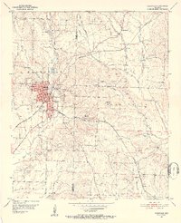
1951 Map of Nashville
USGS Topo · Published 1952About this map
The town of Nashville serves as the focal point of this early 1950s survey, marked by the prominent Courthouse, Post Office, and Howard County Memorial Hospital. The community's infrastructure is well-defined by the Missouri Pacific railroad and the Nashville Airport located to the north. Outside the main settlement, the landscape transitions into a network of rural crossroads and farming communities like Bingen, North Bingen, and Clow.
Find a feature on this map
40 named features on this map. Tap any name to fly to it.
Don’t see what you’re looking for? This feature index may not catch every label — zoom into the map to look around manually.
Map Details
Editions of this 1951 Nashville Map
3 editions found
Other maps of this area

1906 · Caddo Gap
USGS Topo · 1:125,000

1951 · Mineral Springs South
USGS Topo · 1:24,000

1951 · Columbus
USGS Topo · 1:24,000

1951 · Mineral Springs North
USGS Topo · 1:24,000

1951 · Nashville
USGS Topo · 1:24,000

1951 · Washington
USGS Topo · 1:24,000

1951 · McCaskill
USGS Topo · 1:24,000

1953 · El Dorado
USGS Topo · 1:250,000

1955 · Little Rock
USGS Topo · 1:250,000

1956 · Little Rock
USGS Topo · 1:250,000