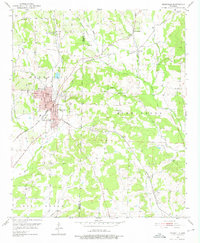
1951 Map of Nashville
USGS Topo · Published 1976About this map
The town of Nashville serves as a busy hub in the early 1950s, defined by the convergence of the Missouri Pacific railroad and local timber or agricultural transit routes like the Graysonia Nashville and Ashdown. The landscape is dotted with rural centers of community life, including numerous country churches such as Antioch Ch, Oak Grove Ch, and Unity Ch.
Find a feature on this map
38 named features on this map. Tap any name to fly to it.
Don’t see what you’re looking for? This feature index may not catch every label — zoom into the map to look around manually.
Map Details
Editions of this 1951 Nashville Map
3 editions found
Other maps of this area

1906 · Caddo Gap
USGS Topo · 1:125,000

1951 · Mineral Springs South
USGS Topo · 1:24,000

1951 · Columbus
USGS Topo · 1:24,000

1951 · Mineral Springs North
USGS Topo · 1:24,000

1951 · Nashville
USGS Topo · 1:24,000

1951 · Washington
USGS Topo · 1:24,000

1951 · McCaskill
USGS Topo · 1:24,000

1953 · El Dorado
USGS Topo · 1:250,000

1955 · Little Rock
USGS Topo · 1:250,000

1956 · Little Rock
USGS Topo · 1:250,000