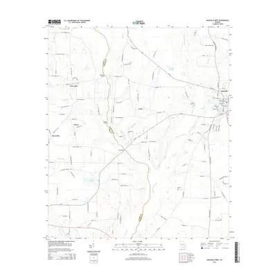
2014 Map of Nashville West
USGS Topo · Published 2014About this map
The Withlacoochee River and its meandering tributary, the New River, form a persistent boundary between Cook and Berrien counties. This landscape is defined by its agricultural legacy, where small settlements like Chaserville, Cottle, and Massee serve as centers for a network of rural roads often named for local families. Genealogists and local historians will find significant detail in the numerous burial grounds scattered across the countryside, including the Old Nashville Cem, West View Cem, and the remote Sandy Bluff Cem. Landmarks such as Buckholts Bridge and Long Bridge mark established crossing points over the river systems, while Beulah Church stands as a focal point for the community west of Nashville. The abundance of smaller waterways like Wolf Br and District Br illustrates the complex drainage patterns that shaped the placement of early homesteads and farms in this region.
Find a feature on this map
121 named features on this map. Tap any name to fly to it.
Don’t see what you’re looking for? This feature index may not catch every label — zoom into the map to look around manually.
Map Details
Editions of this 2014 Nashville West Map
This is the sole edition of this map. No revisions or reprints were ever made.
Other maps of this area

1953 · Waycross
USGS Topo · 1:250,000

1958 · Waycross
USGS Topo · 1:250,000

1972 · Tenmile Bay
USGS Topo · 1:24,000

1973 · Adel
USGS Topo · 1:24,000

1973 · New Lois
USGS Topo · 1:24,000

1973 · Sapps Lake
USGS Topo · 1:24,000

1973 · Cecil
USGS Topo · 1:24,000

1973 · Nashville West
USGS Topo · 1:24,000

1973 · Lenox
USGS Topo · 1:24,000
1978 · Nashville East
USGS Topo · 1:24,000