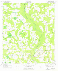
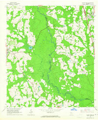
1973 Map of New Lois
USGS Topo · Published 1975About this map
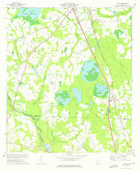
The Withlacoochee River winds through the heart of this South Georgia landscape, defining the jagged boundaries between Cook, Berrien, and Lowndes Counties. In the mid-1970s, this rural corridor was characterized by a network of family-named water bodies and community landmarks, including Hutchinson Pond and Daniels Pond. The settlement of New Lois sits in the northeast, while the southern reaches of the map show the organized grounds of the Boys Ranch and Camp Tygart. Genealogists will find significant value in the distribution of local religious and burial sites such as Pleasant Ch, Money Cem, and Shady Grove Ch, which served the scattered farmsteads connected by routes like Val-Del Road and Hutchinson Mill Road. The presence of Hutchinson Mill Creek suggests the historical importance of water-powered industry in the region's development.
Find a feature on this map
51 named features on this map. Tap any name to fly to it.
Don’t see what you’re looking for? This feature index may not catch every label — zoom into the map to look around manually.
Map Details
Editions of this 1973 New Lois Map
This is the sole edition of this map. No revisions or reprints were ever made.
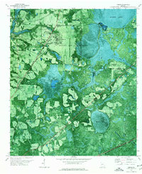
Other maps of this area

1953 · Waycross
USGS Topo · 1:250,000

1954 · Valdosta
USGS Topo · 1:250,000

1958 · Valdosta
USGS Topo · 1:250,000

1958 · Waycross
USGS Topo · 1:250,000

1959 · Valdosta
USGS Topo · 1:250,000

1961 · Hahira East
USGS Topo · 1:24,000
1961 · Hahira West
USGS Topo · 1:24,000
1971 · Bemiss
USGS Topo · 1:24,000
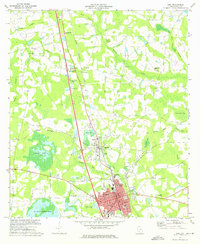
1973 · Adel
USGS Topo · 1:24,000
1973 · Cecil
USGS Topo · 1:24,000