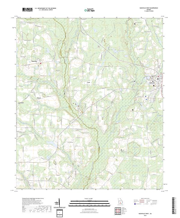
2024 Map of Nashville West
USGS Topo · Published 2024About this map
The Withlacoochee River and New River define the winding agricultural landscape of south-central Georgia, tracing the jurisdictional boundary between Berrien and Cook counties. This contemporary topographic record captures the rural character of the region, where family-named roads and remote crossroads such as Chaserville, Cottle, and Massee connect dispersed farmsteads. To the east, the western edge of Nashville serves as a focal point, anchored by the Berrien County Courthouse and several historic burial grounds, including West View Cem and the Old City Cem. The terrain is punctuated by significant water features and wetlands, such as District Pond, Slash Pond, and Youngs Mill Creek. For those exploring local family histories, the map identifies numerous family landmarks like the Bennett Family Cem and the Sandy Bluff Cem, providing a precise geographic context for the area's genealogical heritage.
Find a feature on this map
128 named features on this map. Tap any name to fly to it.
Don’t see what you’re looking for? This feature index may not catch every label — zoom into the map to look around manually.
Map Details
Editions of this 2024 Nashville West Map
This is the sole edition of this map. No revisions or reprints were ever made.
Other maps of this area

1953 · Waycross
USGS Topo · 1:250,000

1958 · Waycross
USGS Topo · 1:250,000

1972 · Tenmile Bay
USGS Topo · 1:24,000

1973 · Adel
USGS Topo · 1:24,000

1973 · New Lois
USGS Topo · 1:24,000

1973 · Sapps Lake
USGS Topo · 1:24,000

1973 · Cecil
USGS Topo · 1:24,000

1973 · Nashville West
USGS Topo · 1:24,000

1973 · Lenox
USGS Topo · 1:24,000
1978 · Nashville East
USGS Topo · 1:24,000