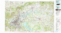
1984 Map of Nashville
USGS Topo · Published 1985About this map
The Cumberland River defines the corridor of development in this mid-1980s regional overview, winding through a landscape of emerging suburban rings and established rural centers. The map documents the significant impact of mid-century water management on the terrain, dominated by the sprawling reaches of Old Hickory Lake and Percy Priest Reservoir. These massive water bodies reshaped the geography of Hendersonville, Mt. Juliet, and La Vergne, creating a new shoreline economy alongside traditional transit routes like the Seaboard System railroad.
Find a feature on this map
123 named features on this map. Tap any name to fly to it.
Don’t see what you’re looking for? This feature index may not catch every label — zoom into the map to look around manually.
Map Details
Editions of this 1984 Nashville Map
This is the sole edition of this map. No revisions or reprints were ever made.
Other maps of this area

1893 · Mc Minnville
USGS Topo · 1:125,000

1895 · Mc Minnville
USGS Topo · 1:125,000

1901 · Colombia
USGS Topo · 1:125,000

1903 · Nashville
USGS Topo · 1:125,000

1908 · Woodbury
USGS Topo · 1:62,500

1909 · Franklin
USGS Topo · 1:62,500

1916 · Murfreesboro
USGS Topo · 1:62,500

1928 · Gordonsville
USGS Topo · 1:62,500

1930 · White Bluff
USGS Topo · 1:62,500

1931 · Lafayette
USGS Topo · 1:62,500