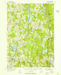
1953 Map of Nassau
USGS Topo · Published 1955About this map
The village of Nassau and its surrounding hill country are captured in detail during the early 1950s, revealing a landscape defined by glacial lakes and small rural crossroads. Along the Valatie Kill and the shores of Nassau Lake, the map shows a shift toward seasonal recreation and community centers, evidenced by Totem Lodge, Rosecrans Park, and the YMCA Camp on Burden Lake. These water bodies, including Glass Lake and Crooked Lake to the north, are flanked by named peaks like Bailey Mtn and Curtis Mountain, which hem in the narrow valleys where settlements like East Nassau and Hoag Corners developed.
Find a feature on this map
54 named features on this map. Tap any name to fly to it.
Don’t see what you’re looking for? This feature index may not catch every label — zoom into the map to look around manually.
Map Details
Editions of this 1953 Nassau Map
4 editions found
Other maps of this area

1888 · Berlin
USGS Topo · 1:62,500

1888 · Pittsfield
USGS Topo · 1:62,500

1890 · Pittsfield
USGS Topo · 1:62,500

1890 · Berlin
USGS Topo · 1:62,500

1893 · Troy
USGS Topo · 1:62,500

1893 · Pittsfield
USGS Topo · 1:62,500

1894 · Berlin
USGS Topo · 1:62,500

1894 · Pittsfield
USGS Topo · 1:62,500

1895 · Troy
USGS Topo · 1:62,500

1897 · Pittsfield
USGS Topo · 1:62,500