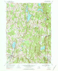
1953 Map of Nassau
USGS Topo · Published 1984About this map
Burden Lake and the surrounding woodlands of Rensselaer County dominate this mid-century landscape, capturing a transition between agricultural land and recreational retreats. The map highlights several seasonal and community hubs, including the YMCA Camp, Totem Lodge, and Methodist Farm near Crooked Lake. These settlements are interconnected by a network of local roads such as Telephone Road and Totem Lodge Road, which link established hamlets like Millers Corners and Hoag Corners.
Find a feature on this map
52 named features on this map. Tap any name to fly to it.
Don’t see what you’re looking for? This feature index may not catch every label — zoom into the map to look around manually.
Map Details
Editions of this 1953 Nassau Map
4 editions found
Other maps of this area

1888 · Berlin
USGS Topo · 1:62,500

1888 · Pittsfield
USGS Topo · 1:62,500

1890 · Pittsfield
USGS Topo · 1:62,500

1890 · Berlin
USGS Topo · 1:62,500

1893 · Troy
USGS Topo · 1:62,500

1893 · Pittsfield
USGS Topo · 1:62,500

1894 · Berlin
USGS Topo · 1:62,500

1894 · Pittsfield
USGS Topo · 1:62,500

1895 · Troy
USGS Topo · 1:62,500

1897 · Pittsfield
USGS Topo · 1:62,500