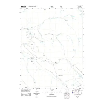
2011 Map of Nast
USGS Topo · Published 2011About this map
Mount Nast and the surrounding high country define this section of the Fryingpan River basin, characterized by a complex network of industrial water management and mining. The landscape is marked by the Fryingpan-Arkansas North Side Collection System, which includes the Nast Tunnel, Chapman Tunnel, and the Charles H Boustead Tunnel, illustrating the massive engineering efforts required to move water across the Continental Divide. Local mining history is preserved through the Carter and Moran Tunnels Mine and the Cunningham Tunnel Mine, which sit tucked away near high-altitude drainages like Mormon Creek. Settled life in this high terrain is sparse, represented by Horseshoe Bend Ranch and several dispersed recreational sites such as Elk Wallow Campground. The hydrology of the area is particularly dense, with numerous alpine bodies of water including Ivanhoe Lake, Sellar Lake, and Savage Lakes feeding into the North Fork Fryingpan River.
Find a feature on this map
50 named features on this map. Tap any name to fly to it.
Don’t see what you’re looking for? This feature index may not catch every label — zoom into the map to look around manually.
Map Details
Editions of this 2011 Nast Map
This is the sole edition of this map. No revisions or reprints were ever made.
Other maps of this area

1889 · Leadville
USGS Topo · 1:125,000

1891 · Leadville
USGS Topo · 1:125,000

1909 · Mount Jackson
USGS Topo · 1:125,000

1911 · Mount Jackson
USGS Topo · 1:125,000

1935 · Mount Elbert
USGS Topo · 1:62,500

1938 · Mount Elbert
USGS Topo · 1:62,500

1939 · Mount Elbert
USGS Topo · 1:62,500

1942 · Leadville
USGS Topo · 1:125,000

1949 · Holy Cross
USGS Topo · 1:62,500

1951 · Holy Cross
USGS Topo · 1:62,500