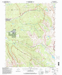
1994 Map of Nast
USGS Topo · Published 1998About this map
The settlement of Nast and the adjacent Coke Oven State Wildlife Area sit at the center of this 1990s mountain study, where the waters of the Fryingpan River and Ivanhoe Creek meet. High-altitude hydrology is the defining characteristic of this landscape, documented through a sophisticated network of water management features including the Fryingpan-Arkansas North Side Collection System, the Boustead Tunnel, and the Nast Tunnel. These engineered systems trace beneath the high peaks, diverting water across the Continental Divide to support development on the eastern slope.
Find a feature on this map
48 named features on this map. Tap any name to fly to it.
Don’t see what you’re looking for? This feature index may not catch every label — zoom into the map to look around manually.
Map Details
Editions of this 1994 Nast Map
This is the sole edition of this map. No revisions or reprints were ever made.
Other maps of this area

1889 · Leadville
USGS Topo · 1:125,000

1891 · Leadville
USGS Topo · 1:125,000

1909 · Mount Jackson
USGS Topo · 1:125,000

1911 · Mount Jackson
USGS Topo · 1:125,000

1935 · Mount Elbert
USGS Topo · 1:62,500

1938 · Mount Elbert
USGS Topo · 1:62,500

1939 · Mount Elbert
USGS Topo · 1:62,500

1942 · Leadville
USGS Topo · 1:125,000

1949 · Holy Cross
USGS Topo · 1:62,500

1951 · Holy Cross
USGS Topo · 1:62,500