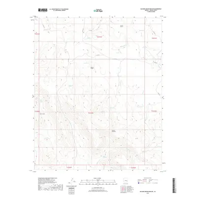
2018 Map of Natanes Mountains NW
USGS Topo · Published 2018About this map
Natanes Plateau dominates this high-altitude landscape in Graham County, where a network of seasonal water sources and canyons defines the remote terrain. This 2018 survey documents a region where water management is critical, as evidenced by the numerous named catchments like Double Circle Tank, Bob Tail Tank, and Squaw Cr Tank. These features, often located near drainages such as Sawmill Cr and Squaw Cr, reflect the historical and ongoing importance of livestock and wildlife watering in the Arizona backcountry. Natural seeps such as Old Summit Springs, Bill Simms Spring, and Soldier Hole Spring are scattered across the slopes of the Natanes Mountains, marking vital points for anyone traversing the high ground between Skunk Canyon and Sawmill Canyon. The map preserves the names of these essential water points and the primitive roads, including Clover Rd and Co RD 1500, that connect this isolated section of the San Carlos Apache Reservation.
Find a feature on this map
37 named features on this map. Tap any name to fly to it.
Don’t see what you’re looking for? This feature index may not catch every label — zoom into the map to look around manually.
Map Details
Editions of this 2018 Natanes Mountains NW Map
This is the sole edition of this map. No revisions or reprints were ever made.
Other maps of this area

1954 · Clifton
USGS Topo · 1:250,000

1954 · Mesa
USGS Topo · 1:250,000

1957 · Mesa
USGS Topo · 1:250,000

1957 · Clifton
USGS Topo · 1:250,000

1958 · Clifton
USGS Topo · 1:250,000

1958 · Mesa
USGS Topo · 1:250,000

1960 · Mesa
USGS Topo · 1:250,000

1962 · Clifton
USGS Topo · 1:250,000

1964 · Mesa
USGS Topo · 1:250,000

1966 · Georges Butte
USGS Topo · 1:24,000