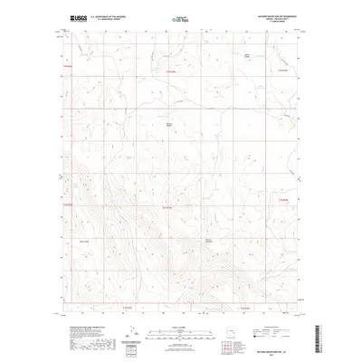
2021 Map of Natanes Mountains NW
USGS Topo · Published 2021About this map
Natanes Plateau and the surrounding high country of the Natanes Mountains define this remote landscape in eastern Arizona. The map details a complex network of ephemeral water sources critical for life and livestock in this arid environment, ranging from named springs like Old Summit Springs and Bill Simms Spring to specialized water catchments including Double Circle Tank and Shoe Tank. This reliance on dispersed water points suggests a history of cattle ranching or land management where permanent surface water is scarce. Significant topographic relief is visible through deep incisions such as Sawmill Canyon and Skunk Canyon, while drainage systems like Sawmill Cr and N Fork Ash Cr move water off the higher elevations. Access to this territory is provided by primitive routes such as Clover Rd and several county roads, reflecting the low-density infrastructure of Graham County.
Find a feature on this map
38 named features on this map. Tap any name to fly to it.
Don’t see what you’re looking for? This feature index may not catch every label — zoom into the map to look around manually.
Map Details
Editions of this 2021 Natanes Mountains NW Map
This is the sole edition of this map. No revisions or reprints were ever made.
Other maps of this area

1954 · Clifton
USGS Topo · 1:250,000

1954 · Mesa
USGS Topo · 1:250,000

1957 · Mesa
USGS Topo · 1:250,000

1957 · Clifton
USGS Topo · 1:250,000

1958 · Clifton
USGS Topo · 1:250,000

1958 · Mesa
USGS Topo · 1:250,000

1960 · Mesa
USGS Topo · 1:250,000

1962 · Clifton
USGS Topo · 1:250,000

1964 · Mesa
USGS Topo · 1:250,000

1966 · Georges Butte
USGS Topo · 1:24,000