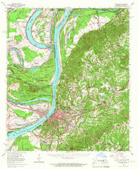
1965 Map of Natchez
USGS Topo · Published 1967About this map
The Mississippi River creates a dynamic western boundary for Adams County in this mid-1960s study, its serpentine path marked by historical engineering feats like the Waterproof Cutoff (1884) and Giles Bend. The landscape is a study in transition, where legacy agricultural estates like Alabama Plantation, Whitehall Plantation, and Canebrake Plantation sit alongside emerging industrial and extraction sites, including the Waverly Point Oil Field and Natchez Port. The city of Natchez serves as the regional anchor, surrounded by smaller communities such as Washington and Cloverdale. Notable cultural and historical landmarks are well-represented, from the Fort Rosalie Hist Site on the river bluffs to Jefferson Military College inland. The terrain is deeply dissected by drainages like St Catherine Creek and Buckner Bayou, which carve through the loess hills east of the river floodplains.
Find a feature on this map
122 named features on this map. Tap any name to fly to it.
Don’t see what you’re looking for? This feature index may not catch every label — zoom into the map to look around manually.
Map Details
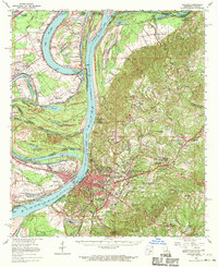
Editions of this 1965 Natchez Map
2 editions found
Other maps of this area

1909 · Sycamore Landing
USGS Topo · 1:24,000

1909 · Vidalia
USGS Topo · 1:24,000

1921 · Natchez
USGS Topo · 1:48,000

1922 · Natchez
USGS Topo · 1:62,500

1939 · Red Gum
USGS Topo · 1:62,500

1939 · Lorman
USGS Topo · 1:62,500

1939 · Natchez
USGS Topo · 1:62,500

1939 · Kingston
USGS Topo · 1:62,500

1939 · Deer Park
USGS Topo · 1:62,500

1939 · Locust Ridge
USGS Topo · 1:62,500