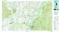
1991 Map of Natchez
USGS Topo · Published 1992About this map
The Mississippi River creates a meandering border between Louisiana and Mississippi, defining the agricultural and flood-prone character of this riverine corridor. On the eastern bluffs, the city of Natchez stands as a primary hub of commerce and transport, mirrored across the water by Vidalia and the nearby rail junction of Ferriday. The landscape is a complex network of oxbow lakes and points, including Cowpen Point and Waverly Point, which illustrate the river's historical shifts.
Find a feature on this map
96 named features on this map. Tap any name to fly to it.
Don’t see what you’re looking for? This feature index may not catch every label — zoom into the map to look around manually.
Map Details
Editions of this 1991 Natchez Map
This is the sole edition of this map. No revisions or reprints were ever made.
Other maps of this area

1909 · Delta Bridge
USGS Topo · 1:24,000

1909 · Sycamore Landing
USGS Topo · 1:24,000

1909 · Lake Bruen
USGS Topo · 1:24,000

1909 · Vidalia
USGS Topo · 1:24,000

1921 · Natchez
USGS Topo · 1:48,000

1922 · Natchez
USGS Topo · 1:62,500

1935 · Winnsboro
USGS Topo · 1:62,500

1935 · Tooleys
USGS Topo · 1:62,500

1935 · Shackleford Lake
USGS Topo · 1:62,500

1939 · Red Gum
USGS Topo · 1:62,500