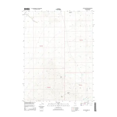
2015 Map of Natchez Spring
USGS Topo · Published 2015About this map
Natchez Spring and a series of vital water sources define the arid geography of this Pershing County landscape during the early 21st century. The terrain is dominated by the high elevations of the Trinity Range and the Poker Brown Mountains, where deep drainages like Black Rock Canyon and Willow Canyon carve through the high desert. The survival of named water points such as Granite Spring, Sportsman Spring, and Marker Spring provides a clear view of the sparse but critical resources that have historically supported ranching and exploration in this portion of the Great Basin. This USGS survey details the Public Land Survey System divisions, including t30n r31e and t29n r30e, illustrating how the land was partitioned across the Trinity Canyon area.
Find a feature on this map
14 named features on this map. Tap any name to fly to it.
Don’t see what you’re looking for? This feature index may not catch every label — zoom into the map to look around manually.
Map Details
Editions of this 2015 Natchez Spring Map
This is the sole edition of this map. No revisions or reprints were ever made.
Other maps of this area

1931 · Lovelock
USGS Topo · 1:250,000

1935 · Lovelock
USGS Topo · 1:250,000

1955 · Lovelock
USGS Topo · 1:250,000

1956 · Oreana
USGS Topo · 1:62,500

1959 · Lovelock
USGS Topo · 1:250,000

1971 · Poker Brown
USGS Topo · 1:24,000

1981 · Natchez Spring
USGS Topo · 1:24,000

1981 · Trinity Pass
USGS Topo · 1:24,000
1981 · Poker Brown Gap
USGS Topo · 1:24,000

1981 · Poker Brown Spring
USGS Topo · 1:24,000