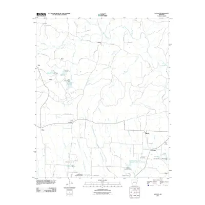
2011 Map of Nathan
USGS Topo · Published 2011About this map
Nathan sits at the junction of several rural roads in this part of Arkansas, where the landscape is defined by its complex network of managed waterways and family-named landmarks. The area south of Highland is heavily influenced by the North Fork Ozan Creek drainage system, which includes the North Fork Ozan Creek Watershed Number Two Reservoir and several dammed sites such as Teeter Lake and Davis Lake. These reservoirs and ponds indicate a reliance on local water management for agriculture or industry during this era.
Find a feature on this map
71 named features on this map. Tap any name to fly to it.
Don’t see what you’re looking for? This feature index may not catch every label — zoom into the map to look around manually.
Map Details
Editions of this 2011 Nathan Map
This is the sole edition of this map. No revisions or reprints were ever made.
Other maps of this area

1906 · Caddo Gap
USGS Topo · 1:125,000

1951 · Mineral Springs North
USGS Topo · 1:24,000

1951 · Nashville
USGS Topo · 1:24,000

1951 · McCaskill
USGS Topo · 1:24,000

1953 · El Dorado
USGS Topo · 1:250,000

1955 · Little Rock
USGS Topo · 1:250,000

1956 · Little Rock
USGS Topo · 1:250,000

1957 · El Dorado
USGS Topo · 1:250,000

1958 · El Dorado
USGS Topo · 1:250,000

1960 · El Dorado
USGS Topo · 1:250,000