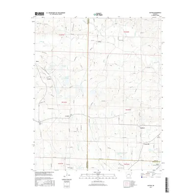
2017 Map of Nathan
USGS Topo · Published 2017About this map
Nathan sits at the crossing of several rural county roads in this 2017 survey of the southwest Arkansas timberlands. The landscape is defined by the headwaters of the Muddy Fork, where small tributaries like Bacon Cr and Brushy Cr drain south through forested tracts. Local history and genealogy are anchored by several remote burial grounds, including Polk Cem to the north and Corinth Cem near the settlement of Corinth. To the west, industrial water management is visible at Briar Plant Lake One and its sister reservoirs, while the Howard County Airport serves as a modern transportation link. The southern edge of the map transitions toward the small communities of Highland and Tokio, where the terrain flattens out around N Fork Ozan Cr and its associated watershed reservoirs.
Find a feature on this map
64 named features on this map. Tap any name to fly to it.
Don’t see what you’re looking for? This feature index may not catch every label — zoom into the map to look around manually.
Map Details
Editions of this 2017 Nathan Map
This is the sole edition of this map. No revisions or reprints were ever made.
Other maps of this area

1906 · Caddo Gap
USGS Topo · 1:125,000

1951 · Mineral Springs North
USGS Topo · 1:24,000

1951 · Nashville
USGS Topo · 1:24,000

1951 · McCaskill
USGS Topo · 1:24,000

1953 · El Dorado
USGS Topo · 1:250,000

1955 · Little Rock
USGS Topo · 1:250,000

1956 · Little Rock
USGS Topo · 1:250,000

1957 · El Dorado
USGS Topo · 1:250,000

1958 · El Dorado
USGS Topo · 1:250,000

1960 · El Dorado
USGS Topo · 1:250,000