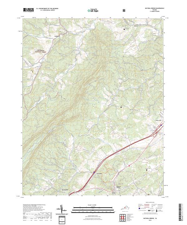
2022 Map of Natural Bridge
USGS Topo · Published 2022About this map
Natural Bridge stands as the centerpiece of this terrain, where the iconic geological formation serves as a focal point for the surrounding Rockbridge County landscape. The area is defined by the winding course of Cedar Creek and the Short Hills range, which creates a complex series of ridges and hollows such as Tory Hollow and Dry Hollow. Small settlements and naming conventions like Red Mills, Buck-Hill, and Fancy Hill suggest a long history of local commerce and community life concentrated along the valley floors.
Find a feature on this map
90 named features on this map. Tap any name to fly to it.
Don’t see what you’re looking for? This feature index may not catch every label — zoom into the map to look around manually.
Map Details
Editions of this 2022 Natural Bridge Map
This is the sole edition of this map. No revisions or reprints were ever made.
Other maps of this area

1894 · Natural Bridge
USGS Topo · 1:125,000

1894 · Lexington
USGS Topo · 1:125,000

1894 · Natural Bridge
USGS Topo · 1:62,500

1907 · Natural Bridge Special
USGS Topo · 1:62,500

1932 · Lexington
USGS Topo · 1:48,000

1935 · Buena Vista
USGS Topo · 1:48,000

1937 · Lexington
USGS Topo · 1:62,500

1939 · Buena Vista
USGS Topo · 1:62,500

1940 · Buena Vista
USGS Topo · 1:62,500

1946 · Millboro
USGS Topo · 1:62,500