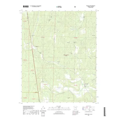
2020 Map of Natural Dam
USGS Topo · Published 2020About this map
Natural Dam serves as a focal point where the Mountain Fork meets Lee Creek near the Arkansas-Oklahoma state line. This 2020 survey of Crawford County reveals a landscape defined by the rugged elevations of the Ozark National Forest, featuring prominent landmarks like Chinkapin Knob and Grapevine Ridge. The settlement of Davidson is situated along the western edge, near the Adair County border, while the surrounding hills are marked by numerous hollows such as Ashley Hollow and Whitten Hollow.
Find a feature on this map
53 named features on this map. Tap any name to fly to it.
Don’t see what you’re looking for? This feature index may not catch every label — zoom into the map to look around manually.
Map Details
Editions of this 2020 Natural Dam Map
This is the sole edition of this map. No revisions or reprints were ever made.
Other maps of this area

1898 · Winslow #3
USGS Topo · 1:62,500

1898 · Tahlequah
USGS Topo · 1:125,000

1898 · Winslow
USGS Topo · 1:125,000

1901 · Winslow
USGS Topo · 1:125,000

1901 · Tahlequah
USGS Topo · 1:125,000

1905 · Tahlequah
USGS Topo · 1:125,000

1946 · Fort Smith
USGS Topo · 1:250,000

1965 · Fort Smith
USGS Topo · 1:250,000

1967 · Fort Smith
USGS Topo · 1:250,000
1969 · Uniontown
USGS Topo · 1:24,000