
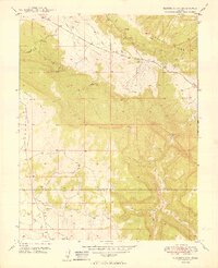
1949 Map of Naturita NW
USGS Topo · Published 1949About this map
The Paradox Valley floor and the surrounding high country of Monogram Mesa characterize this 1949 survey of western Colorado. This specific landscape captures a critical moment in the region's uranium and vanadium mining history, centered on the Thunderbolt Mine and nearby Thunderbolt Spring. The topography transitions from the dramatic cliffs of Sawtooth Ridge down to the arid drainages of Dry Creek and its various branches, including West Fork Dry Creek and East Fork Dry Creek. The map also documents the boundary between Montrose and San Miguel Counties, providing a clear record of land use and resource extraction just as the post-war mining boom was intensifying in the Colorado Plateau. Water sources, vital for both mining operations and ranching, are meticulously noted, from Eddie Lake to the seasonal flow of East Paradox Creek.
Find a feature on this map
12 named features on this map. Tap any name to fly to it.
Don’t see what you’re looking for? This feature index may not catch every label — zoom into the map to look around manually.
Map Details
Editions of this 1949 Naturita NW Map
2 editions found
Other maps of this area

1916 · Paradox Valley
USGS Topo · 1:125,000

1922 · Paradox Valley
USGS Topo · 1:125,000

1948 · Bull Canyon
USGS Topo · 1:24,000

1948 · Uravan
USGS Topo · 1:24,000

1948 · Hamm Canyon
USGS Topo · 1:24,000

1948 · Naturita NW
USGS Topo · 1:24,000

1948 · Gypsum Gap
USGS Topo · 1:24,000

1949 · Bull Canyon
USGS Topo · 1:24,000

1949 · Davis Mesa
USGS Topo · 1:24,000

1949 · Gypsum Gap
USGS Topo · 1:24,000