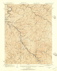
1926 Map of Naugatuck
USGS Topo · Published 1957About this map
Kermit and Warfield sit on opposite banks of the Tug Fork during the mid-1920s, a period when the river valley served as the industrial and transportation spine for Mingo and Martin counties. The Norfolk And Western railroad winds tightly through the valley, connecting coal-rich settlements like Blocton, Himler, and Stonecoal. The map documents a dense network of early 20th-century mountain life, characterized by dozens of local schools positioned along winding branches, including The Bend Sch, Crum Sch, and the remote Tick Ridge Sch. This topographical record captures the region before mid-century modernization, showing the intricate relationship between the steep terrain of Tick Ridge and the development of valley towns and post offices such as Cassie PO. The presence of landmarks like Naugatuck Den and Swelled Hickory Gap provides a geographical anchor for those researching the early Appalachian coalfield era.
Find a feature on this map
148 named features on this map. Tap any name to fly to it.
Don’t see what you’re looking for? This feature index may not catch every label — zoom into the map to look around manually.
Map Details
Editions of this 1926 Naugatuck Map
This is the sole edition of this map. No revisions or reprints were ever made.
Other maps of this area

1886 · Prestonsburg
USGS Topo · 1:125,000

1887 · Warfield
USGS Topo · 1:125,000

1891 · Warfield
USGS Topo · 1:125,000

1892 · Prestonsburg
USGS Topo · 1:125,000

1892 · Huntington
USGS Topo · 1:125,000

1898 · Huntington
USGS Topo · 1:125,000

1902 · Midkiff
USGS Topo · 1:62,500

1903 · Kenova
USGS Topo · 1:125,000

1904 · Kenova
USGS Topo · 1:125,000

1907 · Midkiff
USGS Topo · 1:62,500