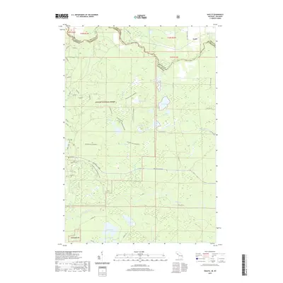
2019 Map of Naults
USGS Topo · Published 2019About this map
The Brule River snakes along the state boundary between Michigan and Wisconsin, defining the northern edge of this remote forested landscape. This portion of the Nicolet National Forest is characterized by the primitive character of the Whisker Lake Wilderness, where numerous small water bodies like Whisker Lake, Camp Thirteen Lake, and Cruiser Lake are accessible only by forest roads and trails. The settlement at Naults sits near the crossing of the river, while the southern reaches of the quadrangle are dominated by the winding course of the Pine River and isolated lakes such as Kieper Lake and Savage Lake. The mapping of Numerous Forest Development Roads, such as fdr709432 and fdr709446, reveals a landscape managed for timber and recreation, with specialized routes like the Florence Co Snowmobile trail and the Beginers snow trail supporting winter activity near the Iron County line.
Find a feature on this map
57 named features on this map. Tap any name to fly to it.
Don’t see what you’re looking for? This feature index may not catch every label — zoom into the map to look around manually.
Map Details
Editions of this 2019 Naults Map
This is the sole edition of this map. No revisions or reprints were ever made.
Other maps of this area

1898 · Iron River
USGS Topo · 1:62,500

1899 · Crystal Falls
USGS Topo · 1:62,500

1939 · Long Lake
USGS Topo · 1:48,000

1941 · Florence
USGS Topo · 1:48,000

1944 · Crystal Falls
USGS Topo · 1:24,000

1944 · Gaastra
USGS Topo · 1:24,000

1944 · Fortune Lakes
USGS Topo · 1:24,000

1946 · Crystal Falls
USGS Topo · 1:31,680

1946 · Gaastra
USGS Topo · 1:31,680

1946 · Fortune Lakes
USGS Topo · 1:31,680