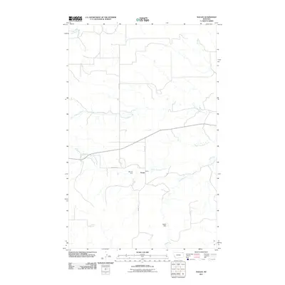
2011 Map of Navajo
USGS Topo · Published 2011About this map
Navajo stands as a primary point of reference in this corner of Daniels County, where the landscape is defined by the branching waterways of the Missouri River basin. The geography is dominated by the intricate drainage systems of North Fork Eagle Creek, Middle Fork Eagle Creek, and Eagle Creek, which create a complex network of seasonal and permanent watercourses. Human impact on the hydrology is visible at McCoys Dam, a critical piece of local infrastructure for water management in the semi-arid plains.
Find a feature on this map
10 named features on this map. Tap any name to fly to it.
Don’t see what you’re looking for? This feature index may not catch every label — zoom into the map to look around manually.
Map Details
Editions of this 2011 Navajo Map
This is the sole edition of this map. No revisions or reprints were ever made.
Other maps of this area

1954 · Wolf Point
USGS Topo · 1:250,000

1958 · Wolf Point
USGS Topo · 1:250,000

1973 · Flaxville
USGS Topo · 1:24,000

1973 · Whitetail
USGS Topo · 1:24,000

1973 · Navajo
USGS Topo · 1:24,000

1973 · Pleasant Prairie NW
USGS Topo · 1:24,000

1973 · Goodale Coulee
USGS Topo · 1:24,000

1973 · Pleasant Prairie NE
USGS Topo · 1:24,000
1983 · Daleview
USGS Topo · 1:24,000

1983 · Redstone
USGS Topo · 1:24,000