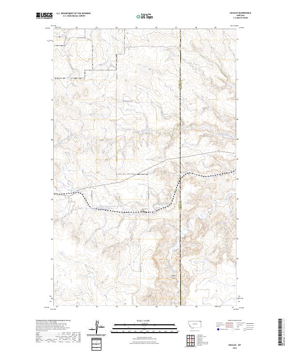
2024 Map of Navajo
USGS Topo · Published 2024About this map
Navajo sits at the heart of this prairie landscape, where the drainage of the Eagle Creek system carves a complex network of coulees across the northeastern Montana plains. The map illustrates a rural area defined by large-scale agricultural divisions and a sparse road network including Meyers Rd and Navajo Rd, which follow the section lines and terrain. To the south, the prominent high point of Eagles Nest rises above the surrounding breaks, providing a significant local landmark.
Find a feature on this map
14 named features on this map. Tap any name to fly to it.
Don’t see what you’re looking for? This feature index may not catch every label — zoom into the map to look around manually.
Map Details
Editions of this 2024 Navajo Map
This is the sole edition of this map. No revisions or reprints were ever made.
Other maps of this area

1954 · Wolf Point
USGS Topo · 1:250,000

1958 · Wolf Point
USGS Topo · 1:250,000

1973 · Flaxville
USGS Topo · 1:24,000

1973 · Whitetail
USGS Topo · 1:24,000

1973 · Navajo
USGS Topo · 1:24,000

1973 · Pleasant Prairie NW
USGS Topo · 1:24,000

1973 · Goodale Coulee
USGS Topo · 1:24,000

1973 · Pleasant Prairie NE
USGS Topo · 1:24,000
1983 · Daleview
USGS Topo · 1:24,000

1983 · Redstone
USGS Topo · 1:24,000