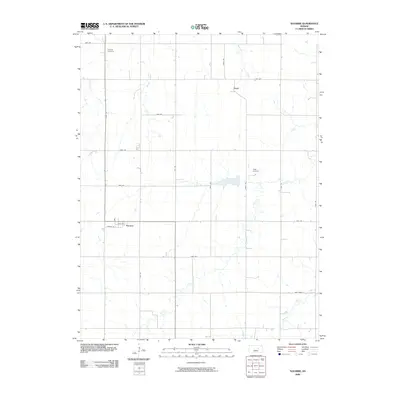
2009 Map of Navarre
USGS Topo · Published 2009About this map
Navarre and the smaller settlement of Pearl anchor this grid-dominated landscape in Dickinson County, where the plains are etched by several vital watercourses. The local hydrology is defined by the wandering paths of Carry Creek, West Branch Lyon Creek, and Swenson Creek, which cut through a strictly ordered network of section-line roads like Oat Rd and Paint Rd. Family and community history is anchored by the Scheittler Cemetery in the northwest and Riffel Cemetery further east. The map illustrates a classic Midwestern agricultural pattern where small rural villages were spaced to serve the surrounding farmsteads. The road nomenclature, including numeric avenues like 1500 Ave, reflects the organized township-and-range surveying system that persists today as the primary framework for transportation and land ownership in the region.
Find a feature on this map
27 named features on this map. Tap any name to fly to it.
Don’t see what you’re looking for? This feature index may not catch every label — zoom into the map to look around manually.
Map Details
Editions of this 2009 Navarre Map
This is the sole edition of this map. No revisions or reprints were ever made.
Other maps of this area

1889 · Abilene
USGS Topo · 1:125,000

1889 · Parkerville
USGS Topo · 1:125,000

1894 · Abilene
USGS Topo · 1:125,000

1894 · Parkerville
USGS Topo · 1:125,000

1955 · Hutchinson
USGS Topo · 1:250,000

1959 · Hutchinson
USGS Topo · 1:250,000

1963 · Abilene SW
USGS Topo · 1:24,000

1964 · Elmo
USGS Topo · 1:24,000
1964 · Chapman
USGS Topo · 1:24,000

1964 · Navarre
USGS Topo · 1:24,000