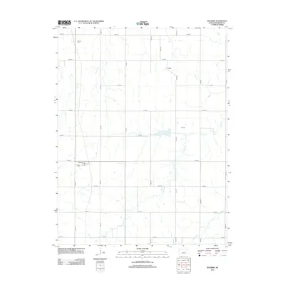
2012 Map of Navarre
USGS Topo · Published 2012About this map
Navarre and Pearl anchor this Dickinson County landscape, reflecting the persistent grid of rural Kansas. The map reveals a strictly organized section-line road system, with routes like Nail Rd and Quail Rd bisecting open country punctuated by small family and community burial grounds. These sites, including Navarre Cem, Riffel Cem, and Scheiller Cem, provide critical touchpoints for genealogists researching the early families of the region. The terrain is defined by the subtle drainage patterns of Carry Cr and the W Br Lyon Cr, which wind through the township blocks. While the village of Navarre shows a small concentration of residential infrastructure along Strole St, the surrounding area remains a portrait of agricultural stability and quiet rural life.
Find a feature on this map
25 named features on this map. Tap any name to fly to it.
Don’t see what you’re looking for? This feature index may not catch every label — zoom into the map to look around manually.
Map Details
Editions of this 2012 Navarre Map
This is the sole edition of this map. No revisions or reprints were ever made.
Other maps of this area

1889 · Abilene
USGS Topo · 1:125,000

1889 · Parkerville
USGS Topo · 1:125,000

1894 · Abilene
USGS Topo · 1:125,000

1894 · Parkerville
USGS Topo · 1:125,000

1955 · Hutchinson
USGS Topo · 1:250,000

1959 · Hutchinson
USGS Topo · 1:250,000

1963 · Abilene SW
USGS Topo · 1:24,000

1964 · Elmo
USGS Topo · 1:24,000
1964 · Chapman
USGS Topo · 1:24,000

1964 · Navarre
USGS Topo · 1:24,000