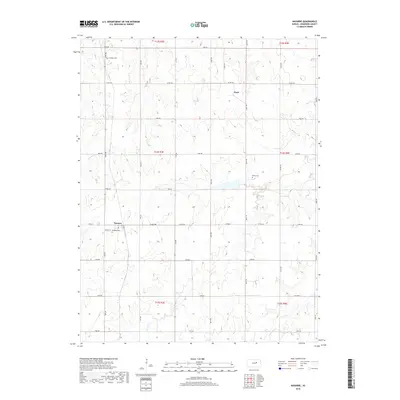
2018 Map of Navarre
USGS Topo · Published 2018About this map
Navarre and Pearl anchor this Dickinson County landscape, representing the persistent rural settlements of the central Kansas plains. The area is defined by a rigorous section-line road grid, including Mink Rd and Sage Rd, which carves the terrain into orderly agricultural blocks. This geometry is occasionally softened by the meandering courses of Carry Cr and the W Br Lyon Cr, where the topography shifts to accommodate these drainage patterns. Local history is preserved in several small burial grounds scattered across the townships, such as Scheiller Cem in the north and Riffel Cem further east. These sites, along with Navarre Cem just south of its namesake town, provide vital touchstones for genealogical research and the study of early settlement clusters in this part of the state.
Find a feature on this map
32 named features on this map. Tap any name to fly to it.
Don’t see what you’re looking for? This feature index may not catch every label — zoom into the map to look around manually.
Map Details
Editions of this 2018 Navarre Map
This is the sole edition of this map. No revisions or reprints were ever made.
Other maps of this area

1889 · Abilene
USGS Topo · 1:125,000

1889 · Parkerville
USGS Topo · 1:125,000

1894 · Abilene
USGS Topo · 1:125,000

1894 · Parkerville
USGS Topo · 1:125,000

1955 · Hutchinson
USGS Topo · 1:250,000

1959 · Hutchinson
USGS Topo · 1:250,000

1963 · Abilene SW
USGS Topo · 1:24,000

1964 · Elmo
USGS Topo · 1:24,000
1964 · Chapman
USGS Topo · 1:24,000

1964 · Navarre
USGS Topo · 1:24,000