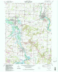
1994 Map of Navarre
USGS Topo · Published 1998About this map
The Tuscarawas River corridor defines the landscape of this region, winding through a terrain shaped by both agricultural tradition and industrial activity. Near the confluence of Sugar Creek and the river, the settlement of Navarre stands as a focal point, while the Beach City Reservoir dominates the southern landscape, managed by the Muskingum Watershed Conservancy District. The map reveals a high density of small family and community burial grounds, such as Slutz Cem, Dietrick Cem, and German Cem, which provide critical touchstones for genealogists researching the early families of the area.
Find a feature on this map
94 named features on this map. Tap any name to fly to it.
Don’t see what you’re looking for? This feature index may not catch every label — zoom into the map to look around manually.
Map Details
Editions of this 1994 Navarre Map
This is the sole edition of this map. No revisions or reprints were ever made.
Other maps of this area

1901 · Massillon
USGS Topo · 1:62,500

1901 · Canton
USGS Topo · 1:62,500

1903 · Massillon
USGS Topo · 1:62,500

1903 · Canton
USGS Topo · 1:62,500

1912 · Dover
USGS Topo · 1:62,500

1914 · Navarre
USGS Topo · 1:62,500

1944 · Navarre
USGS Topo · 1:62,500

1944 · Dover
USGS Topo · 1:62,500

1951 · Canton
USGS Topo · 1:250,000

1951 · Bolivar
USGS Topo · 1:24,000