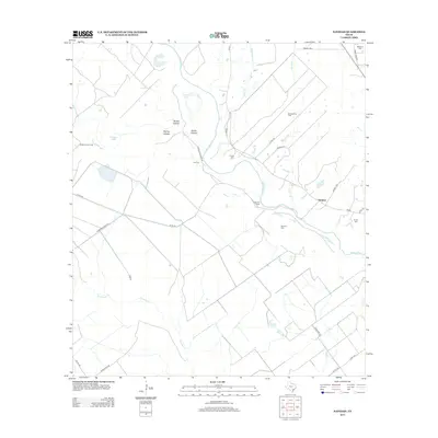
2013 Map of Navidad
USGS Topo · Published 2013About this map
The Lavaca River meanders through this portion of Jackson County, anchoring a landscape defined by cattle ranching and energy extraction. Long-established family names are preserved through numerous burial grounds scattered across the terrain, including Cox Cem, Knopp Cem, McHenry Cem, and Terrell Cem. These sites, along with the Robinson Ranch, speak to the deep-rooted settlement history of the Navidad area. The topographic detail highlights a transition from river bottomlands to higher ground marked by natural depressions like Horseshoe Lake and Alligator Lake. Industrial activity is evident in the Navidad Gas Field and McDaniel Gas Field, which operate alongside traditional agricultural land. Local drainage is further defined by several tributaries, such as Beard Br, Keller Br, and Arenosa Cr, which cut through the hollows of the eastern coastal plain.
Find a feature on this map
39 named features on this map. Tap any name to fly to it.
Don’t see what you’re looking for? This feature index may not catch every label — zoom into the map to look around manually.
Map Details
Editions of this 2013 Navidad Map
This is the sole edition of this map. No revisions or reprints were ever made.
Other maps of this area

1951 · Inez NW
USGS Topo · 1:24,000

1951 · Inez
USGS Topo · 1:24,000

1952 · Edna
USGS Topo · 1:24,000

1953 · Beeville
USGS Topo · 1:250,000

1953 · Seguin
USGS Topo · 1:250,000

1956 · Beeville
USGS Topo · 1:250,000

1958 · Seguin
USGS Topo · 1:250,000

1960 · Beeville
USGS Topo · 1:250,000

1963 · Mount Olive
USGS Topo · 1:24,000

1964 · Cordele
USGS Topo · 1:24,000