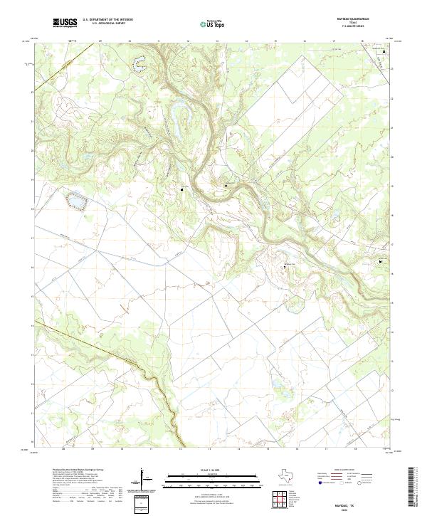
2022 Map of Navidad
USGS Topo · Published 2022About this map
The Lavaca River creates a winding corridor through this coastal prairie landscape, carving oxbows like Horseshoe Lake along the border of Lavaca and Jackson counties. The terrain is defined by a series of distinct drainages and named hollows, including Roden Hollow, McCoy Hollow, and James Hollow, which feed into the river system. This modern survey reveals a rural area deeply connected to its early settlement history through numerous family burial grounds distributed across the countryside. Genealogists can identify the locations of several historic plots, such as Cox Cem near the riverbanks and Wilkerson Cem in the northeastern reaches. Local infrastructure is primarily represented by a network of farm roads, including FM 822 and Chicollette Creek Rd, which provide access to these isolated landmarks and the wetlands surrounding Alligator Lake.
Find a feature on this map
35 named features on this map. Tap any name to fly to it.
Don’t see what you’re looking for? This feature index may not catch every label — zoom into the map to look around manually.
Map Details
Editions of this 2022 Navidad Map
This is the sole edition of this map. No revisions or reprints were ever made.
Other maps of this area

1951 · Inez NW
USGS Topo · 1:24,000

1951 · Inez
USGS Topo · 1:24,000

1952 · Edna
USGS Topo · 1:24,000

1953 · Beeville
USGS Topo · 1:250,000

1953 · Seguin
USGS Topo · 1:250,000

1956 · Beeville
USGS Topo · 1:250,000

1958 · Seguin
USGS Topo · 1:250,000

1960 · Beeville
USGS Topo · 1:250,000

1963 · Mount Olive
USGS Topo · 1:24,000

1964 · Cordele
USGS Topo · 1:24,000