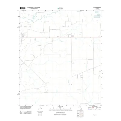
2012 Map of Neale
USGS Topo · Published 2012About this map
The Neale Oil Field and East Neale Gas Field define the industrial footprint of this Beauregard Parish landscape in the early 21st century. The terrain is a network of slow-moving waterways including Trout Cr, Beckwith Cr, and Bridge Cr, which feed into the low-lying Persimmon Marsh. Small settlements like Neale and Pujo are connected by a rural road system often named for local families, such as Addie T Nations Rd and Paul McMillian Rd. Historical continuity is anchored by the Cooper Cem, situated near the crossing of Trout Cr north of the main oil operations. The map illustrates a quiet transition between resource extraction and the natural drainage patterns of the coastal plain, with numerous small loops and spurs serving isolated homesteads and drilling sites.
Find a feature on this map
70 named features on this map. Tap any name to fly to it.
Don’t see what you’re looking for? This feature index may not catch every label — zoom into the map to look around manually.
Map Details
Editions of this 2012 Neale Map
This is the sole edition of this map. No revisions or reprints were ever made.
Other maps of this area

1946 · Merryville
USGS Topo · 1:31,680

1947 · Singer
USGS Topo · 1:31,680

1947 · Pujo
USGS Topo · 1:31,680

1947 · DeRidder
USGS Topo · 1:31,680

1947 · Rosepine
USGS Topo · 1:31,680

1947 · Knight
USGS Topo · 1:31,680

1947 · Bivens
USGS Topo · 1:31,680

1947 · Beckwith School
USGS Topo · 1:31,680

1949 · Evans
USGS Topo · 1:31,680

1952 · Lake Charles
USGS Topo · 1:250,000