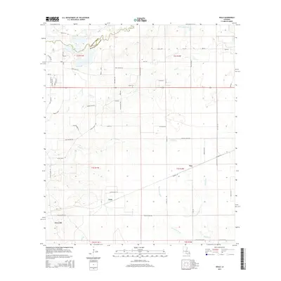
2015 Map of Neale
USGS Topo · Published 2015About this map
Merryville anchor the southwestern portion of this landscape at the border of Vernon Parish and Beauregard Parish. The area is defined by a dense network of watercourses, including the prominent Bayou Anacoco in the northwest and the winding Persimmon Marsh to the south. Small settlements like Neale and Pujo serve as local hubs for a rural road system often named for the families who settled here, such as Hamp Jones Rd, Bob Carsey Rd, and Paul McMillian Rd. Genealogical interest is centered at the Cooper Cem near the center of the quadrangle. The terrain shows a transition from the upland ridges near Tilly Spring down to the wet bottomlands of Beckwith Cr and Bear Head Cr, illustrating the drainage patterns that have historically shaped land use and property boundaries in this part of Louisiana.
Find a feature on this map
65 named features on this map. Tap any name to fly to it.
Don’t see what you’re looking for? This feature index may not catch every label — zoom into the map to look around manually.
Map Details
Editions of this 2015 Neale Map
This is the sole edition of this map. No revisions or reprints were ever made.
Other maps of this area

1946 · Merryville
USGS Topo · 1:31,680

1947 · Singer
USGS Topo · 1:31,680

1947 · Pujo
USGS Topo · 1:31,680

1947 · DeRidder
USGS Topo · 1:31,680

1947 · Rosepine
USGS Topo · 1:31,680

1947 · Knight
USGS Topo · 1:31,680

1947 · Bivens
USGS Topo · 1:31,680

1947 · Beckwith School
USGS Topo · 1:31,680

1949 · Evans
USGS Topo · 1:31,680

1952 · Lake Charles
USGS Topo · 1:250,000