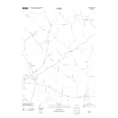
2013 Map of Nebo
USGS Topo · Published 2013About this map
Nebo and its surrounding rural corridors in Webster County are defined by a network of creeks and small settlements in the early 2010s. The landscape is carved by Slover Creek and Whiteside Cr, creating a drainageway that influenced the placement of older hamlets like Lisman, Stanhope, and Jolly. Near the western edge, the Providence-Webster County Airport serves as a modern anchor, while the southern reaches feature the industrial and recreational waters of Shamrock Lake. This survey provides a clear view of the agricultural and residential transition, where family-named roads like Jim Villines Rd and Hayes Rd connect these dispersed communities. Notable elevations such as Balls Hill stand as prominent landmarks in an area otherwise characterized by the steady flow of Bull Cr and Farmers Cr.
Find a feature on this map
76 named features on this map. Tap any name to fly to it.
Don’t see what you’re looking for? This feature index may not catch every label — zoom into the map to look around manually.
Map Details
Editions of this 2013 Nebo Map
This is the sole edition of this map. No revisions or reprints were ever made.
Other maps of this area

1906 · Sebree
USGS Topo · 1:62,500

1907 · Earlington
USGS Topo · 1:48,000

1907 · Morganfield
USGS Topo · 1:62,500

1909 · Earlington
USGS Topo · 1:62,500

1909 · Providence
USGS Topo · 1:62,500

1949 · Sebree
USGS Topo · 1:24,000

1951 · Dixon
USGS Topo · 1:24,000
1951 · Bordley
USGS Topo · 1:24,000

1951 · Sebree
USGS Topo · 1:24,000

1954 · Evansville
USGS Topo · 1:250,000