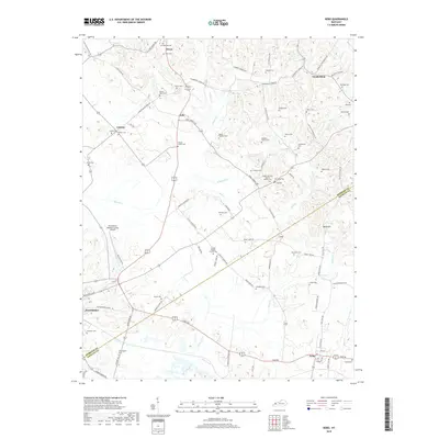
2019 Map of Nebo
USGS Topo · Published 2019About this map
The town of Providence and the community of Nebo anchor this agricultural and rolling landscape on the border of Webster and Hopkins Counties. This area is characterized by an exceptionally high density of family burial grounds and small churchyards, reflecting a long-standing pattern of localized rural settlement. From the Lisman Family Cem near Lisman to the McCoy-Gardner Cem, these sites are scattered across the uplands between Slover Cr and Rose Creek.
Find a feature on this map
95 named features on this map. Tap any name to fly to it.
Don’t see what you’re looking for? This feature index may not catch every label — zoom into the map to look around manually.
Map Details
Editions of this 2019 Nebo Map
This is the sole edition of this map. No revisions or reprints were ever made.
Other maps of this area

1906 · Sebree
USGS Topo · 1:62,500

1907 · Earlington
USGS Topo · 1:48,000

1907 · Morganfield
USGS Topo · 1:62,500

1909 · Earlington
USGS Topo · 1:62,500

1909 · Providence
USGS Topo · 1:62,500

1949 · Sebree
USGS Topo · 1:24,000

1951 · Dixon
USGS Topo · 1:24,000
1951 · Bordley
USGS Topo · 1:24,000

1951 · Sebree
USGS Topo · 1:24,000

1954 · Evansville
USGS Topo · 1:250,000