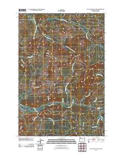
2011 Map of Necanicum Junction
USGS Topo · Published 2011About this map
The Necanicum River basin serves as the primary drainage for this corner of Clatsop County, where the Necanicum Junction marks the convergence of local transit routes and timber access roads. This landscape is defined by the headwaters of several critical coastal systems, including the South Fork Lewis and Clark River and its numerous tributaries such as Beerman Creek and Klootchie Creek. The terrain rises sharply toward prominent landmarks like Twin Peaks and Davis Point, providing a strategic overlook for the Clatsop Fire Tower. Significant logging and forestry infrastructure is visible through the presence of the Necanicum Mainline, which navigates the steep valleys alongside creeks like Wolf Creek and Little Humbug Creek. Historically minded researchers will find interest in the intersection of naming conventions between natural features and the early road network, including Hamlet Rd and County Rd 10.
Find a feature on this map
26 named features on this map. Tap any name to fly to it.
Don’t see what you’re looking for? This feature index may not catch every label — zoom into the map to look around manually.
Map Details
Editions of this 2011 Necanicum Junction Map
This is the sole edition of this map. No revisions or reprints were ever made.
Other maps of this area

1919 · Astoria
USGS Topo · 1:62,500

1939 · Astoria
USGS Topo · 1:62,500

1939 · Saddle Mountain
USGS Topo · 1:62,500

1940 · Svensen
USGS Topo · 1:62,500

1940 · Cape Falcon
USGS Topo · 1:62,500

1943 · Saddle Mtn.
USGS Topo · 1:62,500

1948 · Vancouver
USGS Topo · 1:250,000

1949 · Tillamook Head
USGS Topo · 1:24,000

1949 · Green Mountain
USGS Topo · 1:24,000

1949 · Gearhart
USGS Topo · 1:24,000