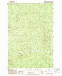
1985 Map of Necanicum Junction
USGS Topo · Published 1986About this map
The Lewis and Clark River and its intricate drainage network define this 1980s landscape in Clatsop County. This coastal mountain environment is characterized by the headwaters of the Necanicum River and the South Fork of the Lewis and Clark, where logging and resource extraction are evident through the network of unimproved roads and several marked Quarries. A significant portion of the southern area is dedicated to the Clatsop State Forest, showing the region's long-standing reliance on timber management and forest conservation.
Find a feature on this map
24 named features on this map. Tap any name to fly to it.
Don’t see what you’re looking for? This feature index may not catch every label — zoom into the map to look around manually.
Map Details
Editions of this 1985 Necanicum Junction Map
This is the sole edition of this map. No revisions or reprints were ever made.
Other maps of this area

1919 · Astoria
USGS Topo · 1:62,500

1939 · Astoria
USGS Topo · 1:62,500

1939 · Saddle Mountain
USGS Topo · 1:62,500

1940 · Svensen
USGS Topo · 1:62,500

1940 · Cape Falcon
USGS Topo · 1:62,500

1943 · Saddle Mtn.
USGS Topo · 1:62,500

1948 · Vancouver
USGS Topo · 1:250,000

1949 · Tillamook Head
USGS Topo · 1:24,000

1949 · Green Mountain
USGS Topo · 1:24,000

1949 · Gearhart
USGS Topo · 1:24,000