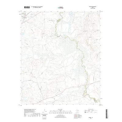
2019 Map of Neches
USGS Topo · Published 2019About this map
Neches sits at the northwestern edge of a landscape defined by the serpentine course of the Neches River, which serves as the natural boundary between Anderson and Cherokee counties. The river valley is characterized by an extensive network of wetlands and oxbow formations, including Dead Water Lake, Horseshoe Lake, and Black Lake. These swampy lowlands contrast sharply with the surrounding uplands, where prominent heights like Daly Mtn and White Mtn rise above the drainage basins of White Oak Cr and Hurricane Cr.
Find a feature on this map
51 named features on this map. Tap any name to fly to it.
Don’t see what you’re looking for? This feature index may not catch every label — zoom into the map to look around manually.
Map Details
Editions of this 2019 Neches Map
This is the sole edition of this map. No revisions or reprints were ever made.
Other maps of this area

1949 · Palestine
USGS Topo · 1:62,500

1950 · Palestine
USGS Topo · 1:62,500

1951 · Elkhart
USGS Topo · 1:62,500

1951 · Jacksonville
USGS Topo · 1:62,500

1952 · Slocum
USGS Topo · 1:62,500

1953 · Palestine
USGS Topo · 1:250,000

1957 · Palestine
USGS Topo · 1:250,000

1981 · Palestine
USGS Topo · 1:100,000
1982 · Maydelle
USGS Topo · 1:24,000
1982 · Jacksonville West
USGS Topo · 1:24,000