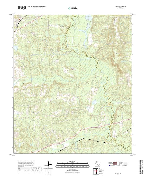
2022 Map of Neches
USGS Topo · Published 2022About this map
Neches sits at the northwestern edge of a landscape defined by the winding course of the Neches River, which forms the boundary between Anderson and Cherokee counties. This modern survey illustrates the complex bottomlands and sloughs of the river basin, featuring water bodies like Alligator Lake, Horseshoe Lake, and Phillips Lake. The upland areas are marked by several cemeteries of significant genealogical interest, including Fields Chapel Cem and Pierces Chapel Cem, alongside smaller family or church plots such as Caldwell Cem.
Find a feature on this map
55 named features on this map. Tap any name to fly to it.
Don’t see what you’re looking for? This feature index may not catch every label — zoom into the map to look around manually.
Map Details
Editions of this 2022 Neches Map
This is the sole edition of this map. No revisions or reprints were ever made.
Other maps of this area

1949 · Palestine
USGS Topo · 1:62,500

1950 · Palestine
USGS Topo · 1:62,500

1951 · Elkhart
USGS Topo · 1:62,500

1951 · Jacksonville
USGS Topo · 1:62,500

1952 · Slocum
USGS Topo · 1:62,500

1953 · Palestine
USGS Topo · 1:250,000

1957 · Palestine
USGS Topo · 1:250,000

1981 · Palestine
USGS Topo · 1:100,000
1982 · Maydelle
USGS Topo · 1:24,000
1982 · Jacksonville West
USGS Topo · 1:24,000