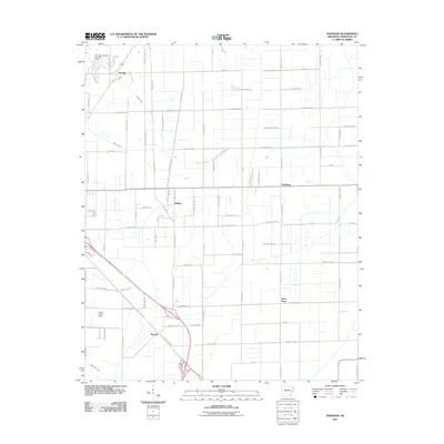
2011 Map of Needham
USGS Topo · Published 2011About this map
Needham and the surrounding Arkansas delta landscape are defined by a meticulous grid of rural roads and scattered small settlements in this 2011 survey. The territory is punctuated by several small airfields, including the Disinger-Farrville Landing Strip in the north and the John Parker Strip further south, suggesting a landscape where aviation serves local agricultural or private needs. Waterways like Bridger Creek and Murray Creek cut across the organized road network, which includes historically named routes such as Rogers Chapel Rd and Old Bridger Rd. Small communities like Farrville, Phillips, and Gum Point anchor different sections of the quadrangle, connected by an extensive system of county roads. The southern portion of the map shows the transition toward Hergett, where the highway infrastructure becomes more complex, contrasting with the steady, quiet township structure found throughout the rest of the region.
Find a feature on this map
96 named features on this map. Tap any name to fly to it.
Don’t see what you’re looking for? This feature index may not catch every label — zoom into the map to look around manually.
Map Details
Editions of this 2011 Needham Map
This is the sole edition of this map. No revisions or reprints were ever made.
Other maps of this area

1939 · Jonesboro
USGS Topo · 1:62,500

1940 · Dee
USGS Topo · 1:62,500

1941 · Leachville
USGS Topo · 1:62,500

1941 · Marked Tree
USGS Topo · 1:62,500

1953 · Memphis
USGS Topo · 1:250,000

1956 · Leachville
USGS Topo · 1:62,500

1956 · Marked Tree
USGS Topo · 1:62,500

1956 · Memphis
USGS Topo · 1:250,000

1958 · Dee
USGS Topo · 1:62,500

1958 · Jonesboro
USGS Topo · 1:62,500