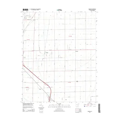
2014 Map of Needham
USGS Topo · Published 2014About this map
Farrville and the surrounding agricultural landscape of Craighead County are captured in this 2014 survey, illustrating the rural settlement patterns east of Jonesboro. The map documents several small community centers, including Phillips, Needham, and Gum Point, which serve as focal points for the local road network. The drainage of the Mississippi Embayment is represented by Bridger Cr and Murray Cr, which wind through the flat terrain between section lines. Further south, the settlement of Hergett sits near the crossing of several county roads, while the northern edge of Bay appears at the bottom of the sheet. Transportation infrastructure is a defining feature here, from the diagonal path of the railway near Whiteman Cr to the Classic Airstrip, which highlights the continued importance of aviation in this region's modern rural economy.
Find a feature on this map
87 named features on this map. Tap any name to fly to it.
Don’t see what you’re looking for? This feature index may not catch every label — zoom into the map to look around manually.
Map Details
Editions of this 2014 Needham Map
This is the sole edition of this map. No revisions or reprints were ever made.
Other maps of this area

1939 · Jonesboro
USGS Topo · 1:62,500

1940 · Dee
USGS Topo · 1:62,500

1941 · Leachville
USGS Topo · 1:62,500

1941 · Marked Tree
USGS Topo · 1:62,500

1953 · Memphis
USGS Topo · 1:250,000

1956 · Leachville
USGS Topo · 1:62,500

1956 · Marked Tree
USGS Topo · 1:62,500

1956 · Memphis
USGS Topo · 1:250,000

1958 · Dee
USGS Topo · 1:62,500

1958 · Jonesboro
USGS Topo · 1:62,500