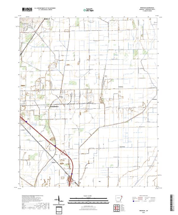
2024 Map of Needham
USGS Topo · Published 2024About this map
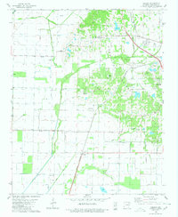
Jonesboro expands eastward across the Arkansas delta in this recent study of the Craighead County landscape. The area is defined by its agricultural grid and critical drainage infrastructure, including the substantial Big Bay Ditch and Bridger Creek, which manage the low-lying terrain. Small, established settlements like Needham and Phillips maintain their identity even as industrial and commercial corridors such as Frito Lay Dr and Nestle Rd signal the region's modern economic shift.
Find a feature on this map
58 named features on this map. Tap any name to fly to it.
Don’t see what you’re looking for? This feature index may not catch every label — zoom into the map to look around manually.
Map Details
Editions of this 2024 Needham Map
This is the sole edition of this map. No revisions or reprints were ever made.
Historical Maps of Phillips Through Time
8 maps found