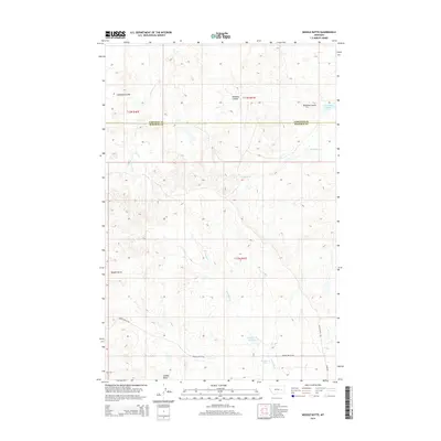
2014 Map of Needle Butte
USGS Topo · Published 2014About this map
Needle Butte and Sunday Butte rise from the high plains along the boundary of Garfield and Rosebud counties, marking a landscape defined by deep drainages and isolated water sources. This 2014 survey reveals a ranching-focused environment where seasonal hydrology is managed through features like the Sunday Cr Reservoir and Clear Water Reservoir. Narrow coulees, including Caladine Coulee and Nordang Coulee, cut through the terrain, channeling runoff toward larger systems such as Lone Tree Cr and S Sunday Cr.
Find a feature on this map
17 named features on this map. Tap any name to fly to it.
Don’t see what you’re looking for? This feature index may not catch every label — zoom into the map to look around manually.
Map Details
Editions of this 2014 Needle Butte Map
This is the sole edition of this map. No revisions or reprints were ever made.
Other maps of this area

1954 · Forsyth
USGS Topo · 1:250,000

1957 · Forsyth
USGS Topo · 1:250,000

1958 · Forsyth
USGS Topo · 1:250,000

1965 · Black Hills
USGS Topo · 1:24,000

1965 · Needle Butte Reservoir
USGS Topo · 1:24,000

1965 · Needle Butte
USGS Topo · 1:24,000

1965 · Clear Water Reservoir
USGS Topo · 1:24,000
1965 · Christenson Reservoir
USGS Topo · 1:24,000
1965 · Hillside
USGS Topo · 1:24,000

1969 · Van Burton Creek
USGS Topo · 1:24,000