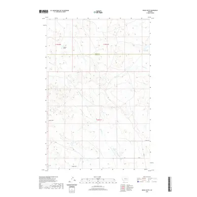
2020 Map of Needle Butte
USGS Topo · Published 2020About this map
Needle Butte and Sunday Butte dominate this section of the Montana landscape, situated along the county line where Garfield and Rosebud meet. The drainage patterns of Lone Tree Cr and Caladine Coulee suggest a complex network of seasonal watercourses that have shaped this high-plains terrain. Modern water management is evident through the placement of Clear Water Reservoir in the northeast and Sunday Cr Reservoir to the south, which capture flow from S Sunday Cr.
Find a feature on this map
17 named features on this map. Tap any name to fly to it.
Don’t see what you’re looking for? This feature index may not catch every label — zoom into the map to look around manually.
Map Details
Editions of this 2020 Needle Butte Map
This is the sole edition of this map. No revisions or reprints were ever made.
Other maps of this area

1954 · Forsyth
USGS Topo · 1:250,000

1957 · Forsyth
USGS Topo · 1:250,000

1958 · Forsyth
USGS Topo · 1:250,000

1965 · Black Hills
USGS Topo · 1:24,000

1965 · Needle Butte Reservoir
USGS Topo · 1:24,000

1965 · Needle Butte
USGS Topo · 1:24,000

1965 · Clear Water Reservoir
USGS Topo · 1:24,000
1965 · Christenson Reservoir
USGS Topo · 1:24,000
1965 · Hillside
USGS Topo · 1:24,000

1969 · Van Burton Creek
USGS Topo · 1:24,000