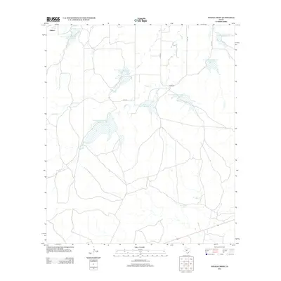
2013 Map of Needle Creek
USGS Topo · Published 2013About this map
Needle Creek and Saddle Creek dominate this Central Texas landscape, where modern water management defines the local geography. The area is marked by a significant network of Soil Conservation Service reservoirs, including Site 14 Reservoir and Site 13 Reservoir, which were engineered to manage runoff and support ranching in the semi-arid McCulloch County environment. The settlement of Lightner sits in the northwestern corner, while the Ford Ranch serves as a major landmark in the central-east. This survey captures the transition from natural drainage to a highly controlled hydrological system, punctuated by traditional watering points like Bee Gum Tank and Willow Tank. A sparse network of county roads, such as Co RD-126 and Co RD-124, connects these remote ranching outposts across the prairie.
Find a feature on this map
20 named features on this map. Tap any name to fly to it.
Don’t see what you’re looking for? This feature index may not catch every label — zoom into the map to look around manually.
Map Details
Editions of this 2013 Needle Creek Map
This is the sole edition of this map. No revisions or reprints were ever made.
Other maps of this area

1887 · Mason
USGS Topo · 1:125,000

1892 · Eden
USGS Topo · 1:125,000

1894 · Brady
USGS Topo · 1:125,000

1894 · Mason
USGS Topo · 1:125,000

1896 · Eden
USGS Topo · 1:125,000

1954 · Brownwood
USGS Topo · 1:250,000

1954 · Llano
USGS Topo · 1:250,000

1955 · Llano
USGS Topo · 1:250,000

1956 · Llano
USGS Topo · 1:250,000

1960 · West Sweden
USGS Topo · 1:24,000