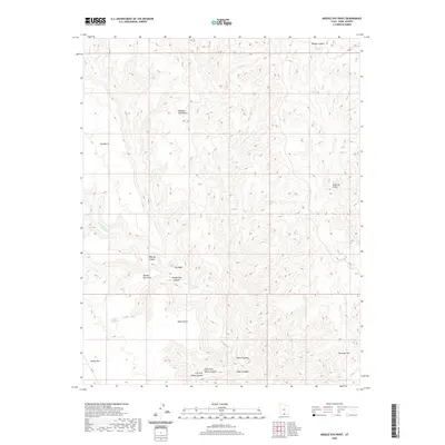
2020 Map of Needle Eye Point
USGS Topo · Published 2020About this map
Needle Eye Point anchors a landscape defined by dramatic geological features and significant relief in southern Kane County. This 2020 edition reveals an intricate network of drainages and named formations, including the sprawling Burning Hills and the prominent Smoky Mtn. Water sources, critical in this arid environment, are specifically identified at Needle Eye Water and along the seasonal flows of Last Chance Cr.
Find a feature on this map
18 named features on this map. Tap any name to fly to it.
Don’t see what you’re looking for? This feature index may not catch every label — zoom into the map to look around manually.
Map Details
Editions of this 2020 Needle Eye Point Map
This is the sole edition of this map. No revisions or reprints were ever made.
Other maps of this area

1886 · Escalante
USGS Topo · 1:250,000

1922 · Warm Creek
USGS Topo · 1:63,360

1922 · Upper Last Chance
USGS Topo · 1:63,360

1922 · Rees Canyon
USGS Topo · 1:63,360

1953 · Nipple Butte
USGS Topo · 1:62,500

1953 · Gunsight Butte
USGS Topo · 1:62,500

1956 · Escalante
USGS Topo · 1:250,000

1960 · Escalante
USGS Topo · 1:250,000

1968 · East of The Navajo
USGS Topo · 1:24,000
1968 · Petes Cove
USGS Topo · 1:24,000