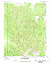
1968 Map of Petes Cove
USGS Topo · Published 1971About this map
Escalante Canyon cuts a winding path through this desert landscape in Kane Co., where high plateaus and deep drainage systems define the territory. Surveyed in the late 1960s, the map reveals a complex system of mesa-like landforms including Paradise Bench, Fourmile Bench, and Caine Bench. These elevated flats are separated by steep-walled corridors like Paradise Canyon and Willard Canyon.
Find a feature on this map
21 named features on this map. Tap any name to fly to it.
Don’t see what you’re looking for? This feature index may not catch every label — zoom into the map to look around manually.
Map Details
Editions of this 1968 Petes Cove Map
2 editions found
Other maps of this area

1886 · Escalante
USGS Topo · 1:250,000

1922 · Upper Last Chance
USGS Topo · 1:63,360

1922 · Rees Canyon
USGS Topo · 1:63,360

1956 · Escalante
USGS Topo · 1:250,000

1960 · Escalante
USGS Topo · 1:250,000

1964 · Seep Flat
USGS Topo · 1:24,000

1964 · Death Ridge
USGS Topo · 1:24,000

1964 · Carcass Canyon
USGS Topo · 1:24,000

1968 · Fourmile Bench
USGS Topo · 1:24,000
1968 · Horse Mtn
USGS Topo · 1:24,000