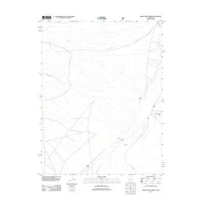
2012 Map of Needle Point Spring
USGS Topo · Published 2012About this map
Hamlin Valley defines this high-desert landscape on the Utah-Nevada border, where water sources dictate the placement of ranching outposts. This 2012 survey documents a network of seasonal drainages and springs, including the namesake Needle Point Spring and Lexington Spring. The settlement of Burbank serves as the primary hub, supported by family operations such as Dearden Ranch, Davies Ranch, and Young Ranch. A sense of local history is grounded at the Burbank Cemetery, situated near the confluence of local washes. The transport network relies on backroads like Black Canyon Rd and various Forest Service routes like NFD 450 Rd, tracing the paths of Lexington Creek and Lake Creek as they flow through the arid basins.
Find a feature on this map
19 named features on this map. Tap any name to fly to it.
Don’t see what you’re looking for? This feature index may not catch every label — zoom into the map to look around manually.
Map Details
Editions of this 2012 Needle Point Spring Map
This is the sole edition of this map. No revisions or reprints were ever made.
Other maps of this area

1949 · Garrison
USGS Topo · 1:62,500

1951 · Garrison
USGS Topo · 1:62,500

1953 · Richfield
USGS Topo · 1:250,000

1956 · Lund
USGS Topo · 1:250,000

1958 · Richfield
USGS Topo · 1:250,000

1960 · Lund
USGS Topo · 1:250,000

1960 · Burbank Hills
USGS Topo · 1:62,500

1971 · Mormon Gap
USGS Topo · 1:24,000
1972 · Tweedy Wash
USGS Topo · 1:24,000

1972 · Big Springs
USGS Topo · 1:24,000