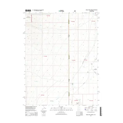
2014 Map of Needle Point Spring
USGS Topo · Published 2014About this map
Hamlin Valley and Antelope Valley Wash dominate this desert basin along the Utah-Nevada state line. The landscape is defined by the drainage of several seasonal waterways, including Lexington Cr, Chokecherry Cr, and Big Springs Cr, which flow toward the northern depression near Pruess Lake. Settlement is sparse and centered on established homesteads like Davies Ranch, Young Ranch, and the Burbank Dearden Ranch, reflecting the region's enduring reliance on cattle ranching in a high-desert environment.
Find a feature on this map
32 named features on this map. Tap any name to fly to it.
Don’t see what you’re looking for? This feature index may not catch every label — zoom into the map to look around manually.
Map Details
Editions of this 2014 Needle Point Spring Map
This is the sole edition of this map. No revisions or reprints were ever made.
Other maps of this area

1949 · Garrison
USGS Topo · 1:62,500

1951 · Garrison
USGS Topo · 1:62,500

1953 · Richfield
USGS Topo · 1:250,000

1956 · Lund
USGS Topo · 1:250,000

1958 · Richfield
USGS Topo · 1:250,000

1960 · Lund
USGS Topo · 1:250,000

1960 · Burbank Hills
USGS Topo · 1:62,500

1971 · Mormon Gap
USGS Topo · 1:24,000
1972 · Tweedy Wash
USGS Topo · 1:24,000

1972 · Big Springs
USGS Topo · 1:24,000