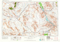
1956 Map of Needles
USGS Topo · Published 1964About this map
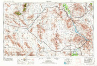
The Colorado River serves as the vital artery of this desert landscape, carving a boundary between California and Arizona while feeding Lake Havasu. This era of the mid-1950s highlights the massive scale of regional water management, evidenced by the Metropolitan Water District Aqueduct and the Iron Mountain Pumping Plant. The Atchison Topeka and Santa Fe railroad strings together a series of isolated stops like Goffs, Essex, and Danby, illustrating how transportation dictated settlement patterns across the Mohave Valley and Ward Valley. Indigenous lands are prominently represented by the Fort Mohave Indian Reservation and the Chemehuevi Indian Reservation. The presence of the Marine Corps Training Center and the Joshua Tree National Monument corner underscores the transition from military utility to federal preservation in the high desert.
Find a feature on this map
79 named features on this map. Tap any name to fly to it.
Don’t see what you’re looking for? This feature index may not catch every label — zoom into the map to look around manually.
Map Details
Editions of this 1956 Needles Map
7 editions found

Other maps of this area

1886 · Diamond Creek
USGS Topo · 1:250,000

1886 · Camp Mohave
USGS Topo · 1:250,000

1892 · Diamond Creek
USGS Topo · 1:250,000

1892 · Camp Mohave
USGS Topo · 1:250,000

1903 · Needles
USGS Topo · 1:125,000

1904 · Needles Special
USGS Topo · 1:125,000

1910 · Ivanpah
USGS Topo · 1:250,000

1911 · Parker
USGS Topo · 1:125,000

1912 · Ivanpah
USGS Topo · 1:250,000

1923 · Signal
USGS Topo · 1:250,000