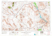
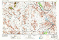
1956 Map of Needles
USGS Topo · Published 1968About this map
The Colorado River serves as the primary artery of life and transportation through this desert expanse, defining the boundary between California and Arizona. Near the river, the Fort Mohave Indian Reservation and Colorado River Indian Reservation represent established cultural centers, while the Colorado River Day School points to localized community infrastructure. Away from the water, the landscape is a grid of arid basins and sharp mountain ranges, including the Old Woman Mountains and Granite Mountains.
Find a feature on this map
52 named features on this map. Tap any name to fly to it.
Don’t see what you’re looking for? This feature index may not catch every label — zoom into the map to look around manually.
Map Details
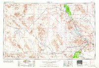
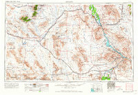
Editions of this 1956 Needles Map
7 editions found

Other maps of this area

1886 · Diamond Creek
USGS Topo · 1:250,000

1886 · Camp Mohave
USGS Topo · 1:250,000

1892 · Diamond Creek
USGS Topo · 1:250,000

1892 · Camp Mohave
USGS Topo · 1:250,000

1903 · Needles
USGS Topo · 1:125,000

1904 · Needles Special
USGS Topo · 1:125,000

1910 · Ivanpah
USGS Topo · 1:250,000

1911 · Parker
USGS Topo · 1:125,000

1912 · Ivanpah
USGS Topo · 1:250,000

1923 · Signal
USGS Topo · 1:250,000